Operation REVUE
In the immediate aftermath of the Second World War, the Air Ministry agreed that the Royal Air Force would undertake Operation REVUE, an aerial photographic survey of the UK that was extended to cover large parts of Europe.
In the UK, the survey was intended to assist the Ordnance Survey in revising its maps of the country but it would also benefit government departments dealing with town planning and transport infrastructure. Designed to produce stereoscopic vertical cover at 1:10,000 scale, with larger scales and oblique photography taken of urban areas, the survey was initially scheduled for completion by the end of 1947, but many areas were re-flown in 1948-9 to rectify deficiencies caused by cloud cover or camera failure.
For Scotland, around 500 sorties were flown during the survey, resulting in the collection of over 280,000 photographic images. These prints and films are now held by NCAP.
'Tedious in the extreme'
Several RAF squadrons were involved in the survey, flying aircraft such as the Spitfire, Mosquito, Lancaster and Anson. With the exception of the pilot and
navigator, who were required to concentrate on keeping a steady course for long periods of time, other crew members found this work to be ‘tedious in the extreme’.
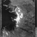
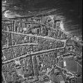
Ardnamurchan St Andrews
Typical Revue imagery
Gerald Stocking and R Davies-Evans were former members of No.90 Squadron, equipped with the Lancaster aircraft, and had this to say about their role in the task:
On each trip an aircraft would be allocated a block of land forty miles by thirty miles. This was divided into ten runs, each three miles apart. When reaching the designated block, success depended upon the ability of the pilot to maintain a steady course, attitude, and speed, and upon the navigator’s map-reading and dexterity with the camera which was set into the floor of the nose-compartment of the aircraft.
We had grown used to the calm voice of the bomb-aimer giving instructions to the Skipper as we approached a target: “Left, left. Steady. Right. Steady. Steady. Bombs gone”. This work, however, involved not a two minute burst of intense concentration but ten runs of fifteen minutes each. Four hundred miles of staring at the flying control panel or peering at the ground through a bomb-sight. For the other five members of the crew, these photographic sorties were tedious in the extreme.
REVUE took us across the UK, Germany, France, Denmark, Norway, Switzerland and Italy. On one Norwegian trip, we were airborne for ten hours - our longest flight. On another, we had to cover three blocks with Mont Blanc in the centre. As our height was set above the mean altitude of the block, this meant that we had to claw our way to twenty-four thousand feet - a record for us.
Our final REVUE trip was on 2nd September 1946. We were to cover part of the Pyrenees and this meant that we would trespass into Spanish airspace. At the briefing we were warned that we could be fired upon. When asked what we should do about that, the intelligence officer's reply was, "Just ignore it".
Review
While the RAF made great efforts to provide the cover required, it experienced some difficulties due to unsuitable aircraft, outdated equipment and the continual rotation of aircrew. However, the benefits of the survey to a whole range of researchers were, and still are, immeasurable. To those such as farmers, foresters, earth scientists, civil engineers, wildlife managers and archaeologists the images collected from 1945-49 offer a window into the landscape of the mid-20th century and are still in great demand today.


